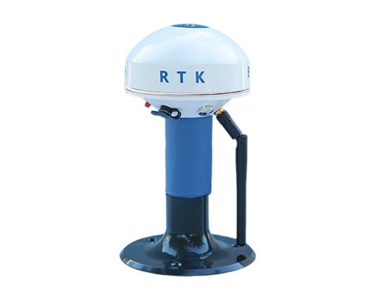
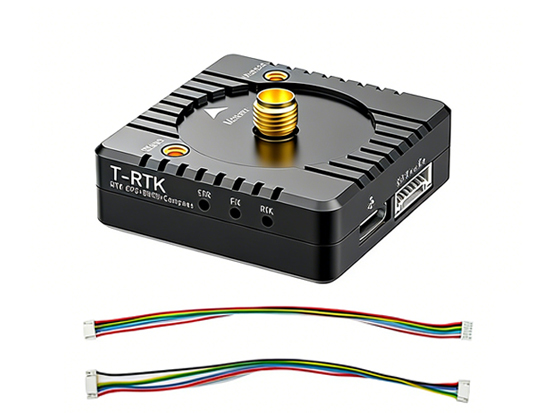
RM-1 is a compact, plug-and-play RTK base station designed for outdoor centimeter-level positioning applications.It is suitable for unmanned vehicles/boats, surveying, and personnel positioning scenarios where stable, high-precision GNSS correction is required.
Features:
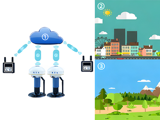
1. Compact & portable: Small footprint for quick field deployment; simple power-up operation.. 2. Plug-and-play (no setup required): Ready to use on power-up, minimizing configuration workload. 3. Multi-constellation tracking: Supports GPS + BDS + GLONASS + Galileo; tracks and processes 40+ satellites. 4. Centimeter-level RTK accuracy: RTK horizontal ±1 cm, vertical ±2 cm (nominal). 5. Wide coverage: Base station coverage stated as > 50 km (deployment/environment dependent). 6. Dual-link communications: 4G priority, and auto-switch to 433 MHz radio when 4G is unavailable; improves continuity in remote areas. 7.Standard correction output: Outputs RTCM messages for base station mode; supports network/CORS usage (CORS function noted as optional). 8. Intelligent base station operating system: Mobile phone control via Bluetooth; simplified operation and status monitoring. 9. Radio interference detection: Evaluates local radio signal quality and recommends better channel selection to reduce co-channel interference risk. 10. Long endurance: Built-in industrial lithium battery; base station runtime >14 h (rover mode stated >20 h). Can be powered by a 5 V power bank for extended operation. 11. Application scenarios: Outdoor positioning, unmanned ground vehicles, unmanned boats, surveying/mapping, and personnel positioning.
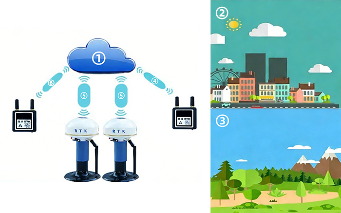
1. Designed to work across different environments
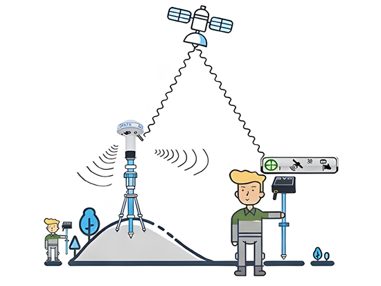
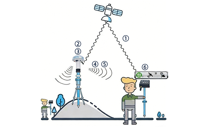
2. Base station
3. Ready to use on power-up; no configuration required
4. Coverage > 50 km
5. self-networking (built-in 4G / 433 MHz radio)
6. Rover (mobile station)
1. Coverage > 50 km
2. 4G priority
3. If 4G is unavailable, automatically switches to 433 MHz radio
4. radio
5. 4G+radio
6. 4G
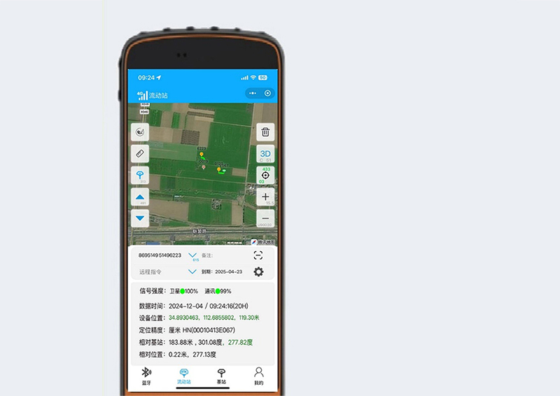
RTK Assistant
Displays key information such as satellite count, signal quality, and battery level
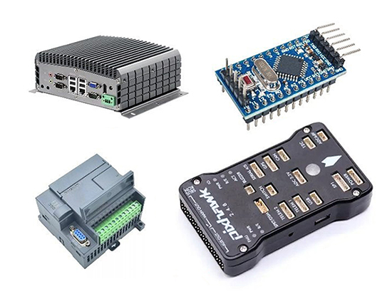
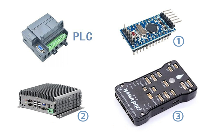
1. Microcontroller (MCU)
2. Industrial PC (IPC)
3. Flight controller
4. Compatible with various hardware platforms
Customizable automotive CAN protocol output
Application:
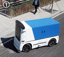
Autonomous Vehicle / UGV
High-performance dual-antenna heading, with industry-leading anti-jamming capability.Provides high-accuracy position, velocity, and attitude reference Makes autonomous driving and intelligent parking more stable and reliable
drone
Centimeter-level carrier-phase measurement accuracy; supports RTK and heading;Agricultural plant protection/spraying, AOPA, line patrol & inspection, environmental monitoring…
USV
4-constellation, 8-frequency; centimeter-level carrier-phase measurement accuracy;Enables environmental surveying, hydrographic/ocean surveying, security & rescue, etc.Safer, more efficient, and lower cost across multiple applications.
Surveying & Mapping
4-constellation, 8-frequency; accuracy advantages from multi-system integrated positioning;Excellent RTK performance in harsh environments;Higher accuracy, more reliable performance.
Parameter
Item
Data
Item
Data
Dimension
10.8 × 17.8 cm
SMA Connector
External 433 MHz radio antenna interface
Satellite Tracking
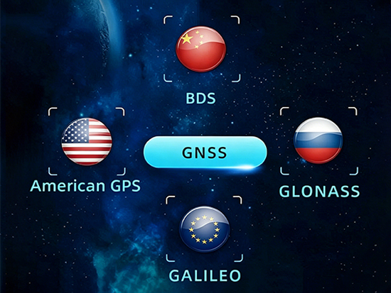
GPS + BDS + Glonass + Galileo
Operating System
Intelligent embedded system
Waterproof
IP68
Initialization Reliability
99.99%
Initialization Time
< 5 s
Indicator
1 LED indicator, displaying device operating status
Battery
Built-in industrial lithium battery; base station operating time > 14 h, rover operating time > 20 h
External Power SuPly
4.8–5.5 V DC
Operating Temperature
-30 °C ~ 70 °C
Storage Temperature
-30 °C ~ 70 °C
Drop Resistance
2 m drop at room temperature (hardwood surface); 1.2 m free fall
Radio
Built-in 433 MHz radio (customizable
Bluetooth
V2.1 + EDR / V4.1 dual-mode, Class 2
Receiver Functions
Dual transmission, one-button startup, base station displacement alarm