The RM-2 series is a modular, stackable GNSS RTK positioning solution based on the UM982 high-precision chipset.It is designed for robotics, autonomous systems, surveying equipment, and other applications requiring centimeter-level positioning and optional heading capability.
The RM-2 series is a modular, stackable GNSS RTK positioning solution based on the UM982 high-precision chipset.It is designed for robotics, autonomous systems, surveying equipment, and other applications requiring centimeter-level positioning and optional heading capability.Unlike single-board RTK modules, RM-2 adopts a flexible module architecture, allowing users to build mobile rovers, base stations, or integrated One-Base solutions according to project requirements.
Features:
Centimeter-Level Positioning Accuracy: RTK horizontal accuracy: 0.8 cm + 1 ppm;RTK vertical accuracy: 1.5 cm + 1 ppm.Supports fast RTK convergence and stable long-term operation.
Multi-Constellation, Multi-Frequency GNSS: Supports GPS, BDS, Galileo, GLONASS, QZSS,Multi-frequency GNSS tracking (including L1/L2/L5 and corresponding signals),Improved availability and robustness in complex environments.
Modular & Stackable Design: Core GNSS module can be combined with:Mobile (Rover) module,Base station module,4G communication module,Long-range radio module (up to 5 km),Modules are stackable, simplifying configuration changes and maintenance.
Optional Dual-Antenna Heading Capability: Supports dual-antenna RTK heading when configured,suitable for unmanned vehicles and robotic platforms requiring precise orientation feedback.
Integrated Wireless & Networking: Built-in WiFi hotspot capability,supports RTK correction data transmission between devices,enables convenient field configuration and diagnostics.
Developer-Friendly Integration: Standard interfaces: UART, USB, PPS, I²C,Open communication protocol,available ROS, Python, and C/C++ drivers,suitable for rapid system integration and secondary development.
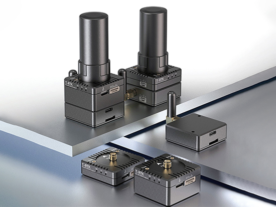
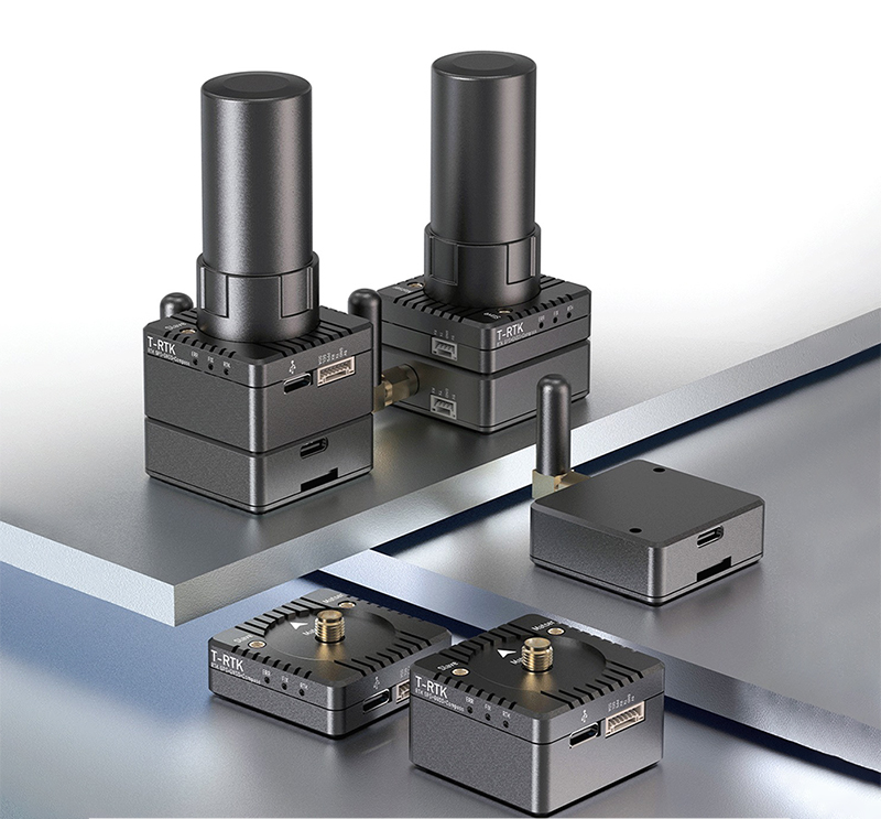
RM-2 Mobile Single Module
① Mobile Devices*1 ② 20CM 7pin-7pin JST-GH Cables*2 ③ 20cm 7pin-10pin JST-HPixhawk GPS *2
RM-2 Base Station Module
① Base Station*1 ② 20cm 7pin-7pin JST-GH Cables*2 ③ 20cm 7pin-10pin JST-GH Pixhawk GPS *2
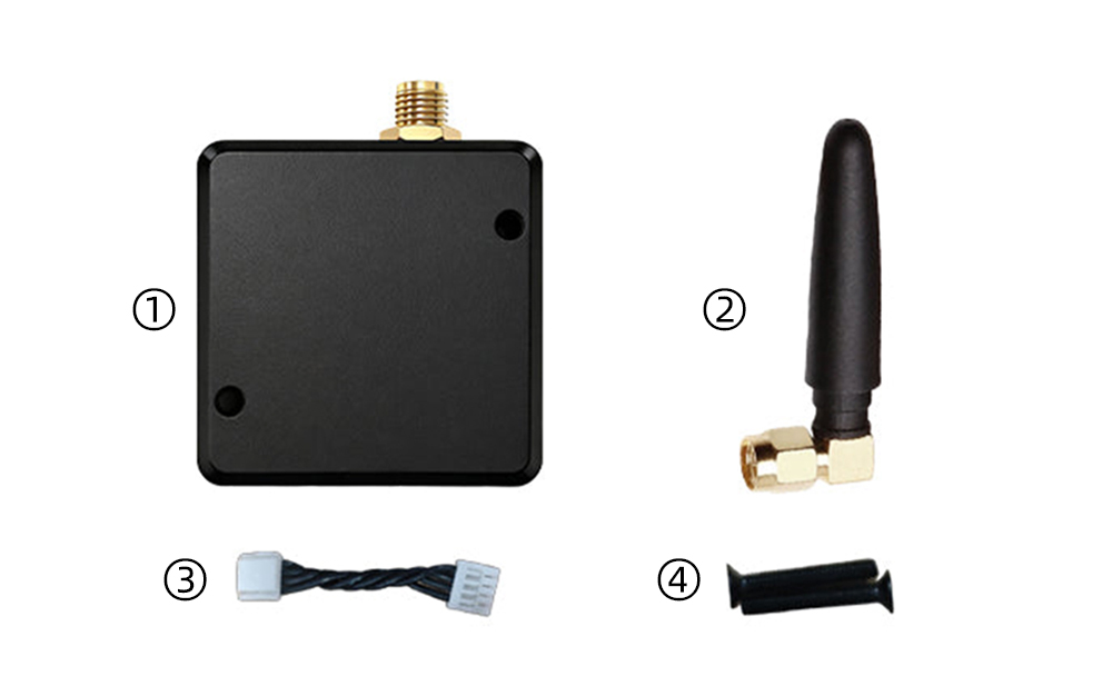
5km Radio Module
① Radio Module*1 ② Radio Antenna*1 ③ GH1.25 4-pin Communication Cable*1 ④ M2.5x14 Counter sunk screws*2
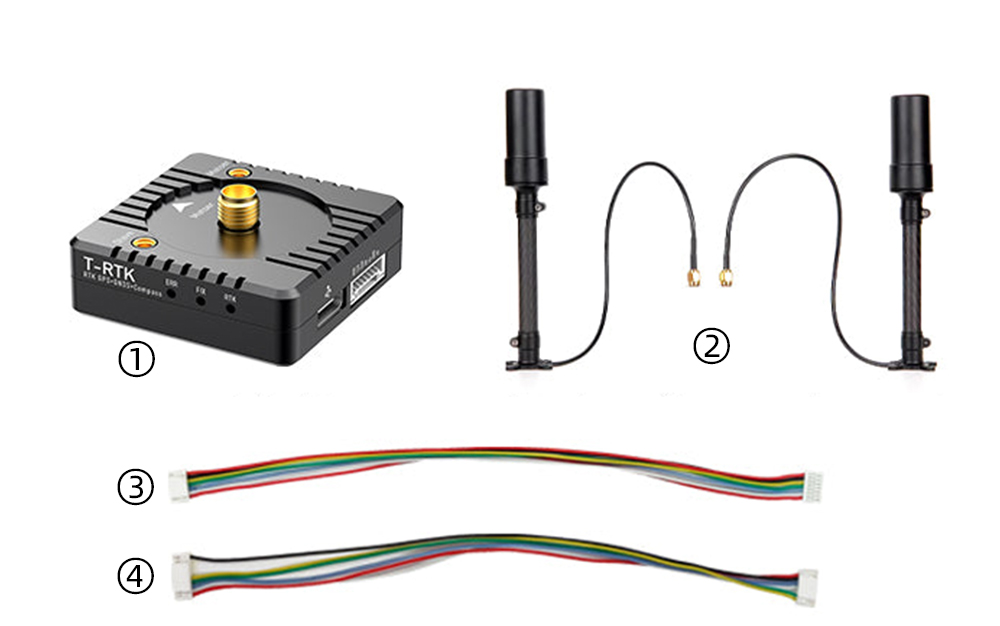
RM-2 Base Package
① Mobile*1 ② Carbon fiber antenna+feeder cable*2 ③ 20cm 7pin-7pin JST-GH Cables*2 ④ 20cm7pin-10pinJST-GH Pixhawk GPS1*2
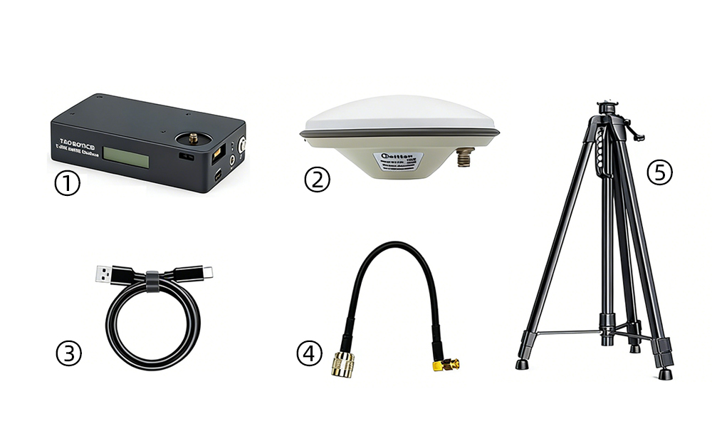
RM-2 Base Package
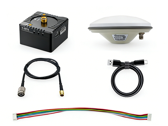
① Base Station*1 ② Mushroom-head antenna*1 ③ 50cm Base Station Feedline*1 ④ 1m Type-C USB Cable*1 ⑤ 20cm 7pin-7pin JST-GH Cables*2
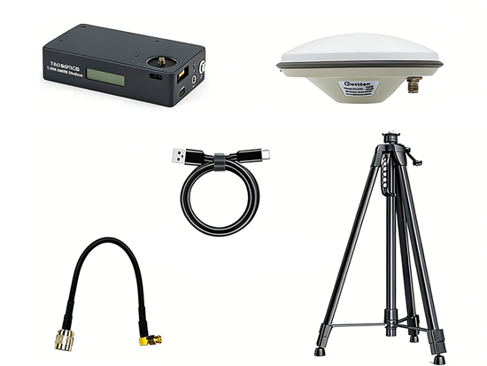
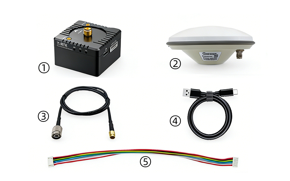
RM-2 One Base Package
① UM982 Base *1 ② Mushroom-head antenna*1 ③ 1m Type-C USB Cable*l ④ 20cm Base station feedline*1 ⑤ 180cm Mounting bracket*1
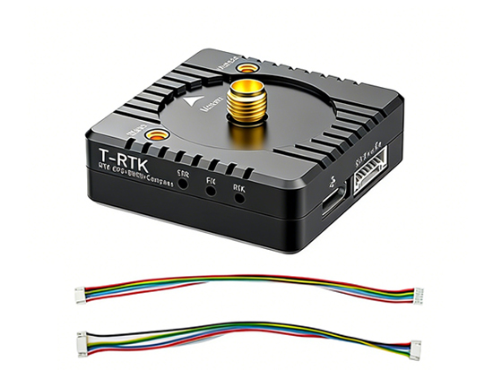
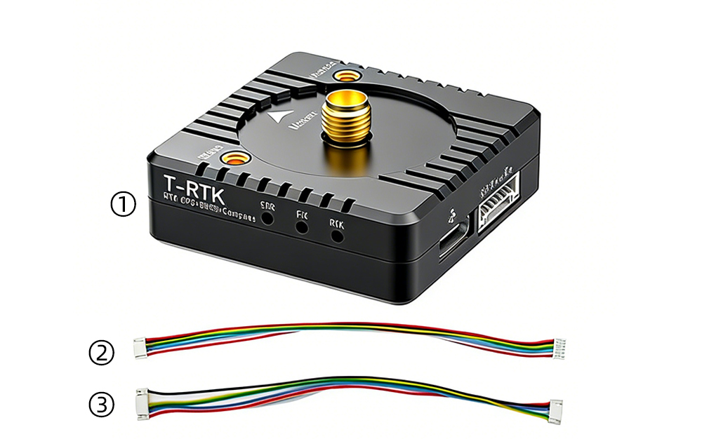
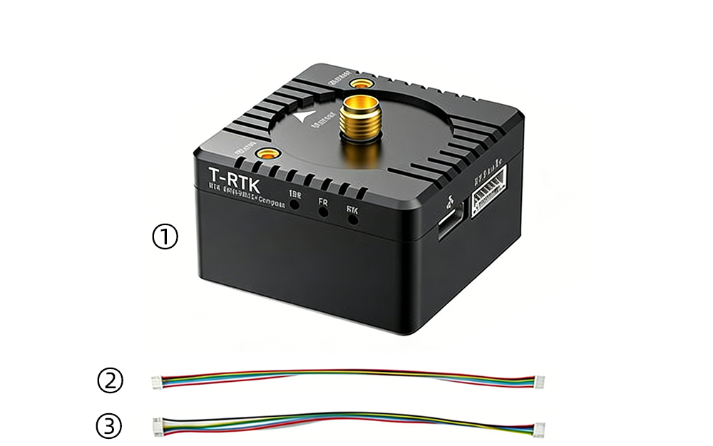
T-RTK UM982 Cost-effective Modular Centimeter-level Satellite Positioning Module:Modular Design, Abundant Interfaces;Built-in Magnetometer, Direct Flight Control Connection;WiFi Hotspot Networking;Secondary Development, Abundant Resources;Integrated Base Station
① All-constellation & All-frequency ② Centimeter-level positioning ③ Multi-platform compatibility ④ Multi-mode communication ⑤ Built-in WiFi ⑥ Modular design ⑦ Multi-antenna interfaces ⑧ Built-in magnetic compass ⑨ Abundant communication interfaces ⑩ Secondary development All-constellation & All-frequency, centimeter-level accuracy Equipped with UM982 high-performance chip, all-constellation & all-frequency, 20Hz high-frequency output Horizontal accuracy 0.8cm + 1ppm, vertical accuracy 1.5cm + 1ppm
Application:
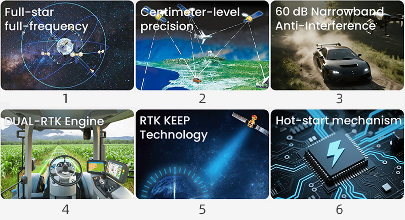
① FUll-star Full-frequency:BDS,GPS,GLONASS,Galileo,QZSS,SBAS ② Centimeter - level precision:Horizontal accuracy: 0.8 cm + 1 ppm Elevation accuracy: 1.5cm+1ppm ③ 60dB Narrowband Anti-interference: Robust anti-interference design ensures stable performance even in complex electromagnetic environments. ④ DUAL-RTK Engine :Dual-antenna independent processing with cross-verification significantly enhances reliability. ⑤ RTK KEEP Technology:Maintains positioning continuity even when the differential link is interrupted ⑥ Hot-start mechanism:Equipped with a built-in uninterruptible power supply system, enabling rapid entry into RTK mode even after a 2-4 hour power outage.
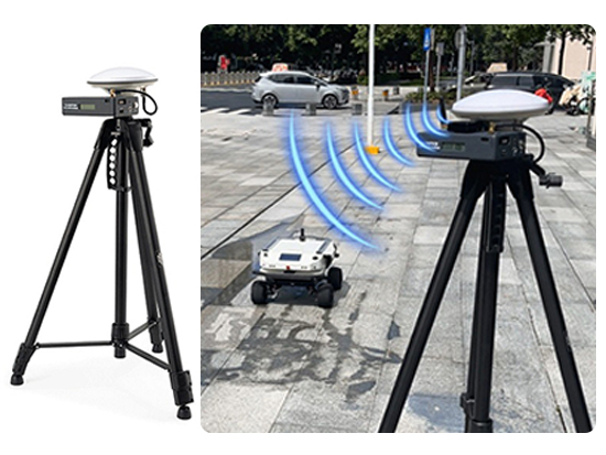
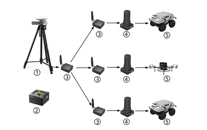
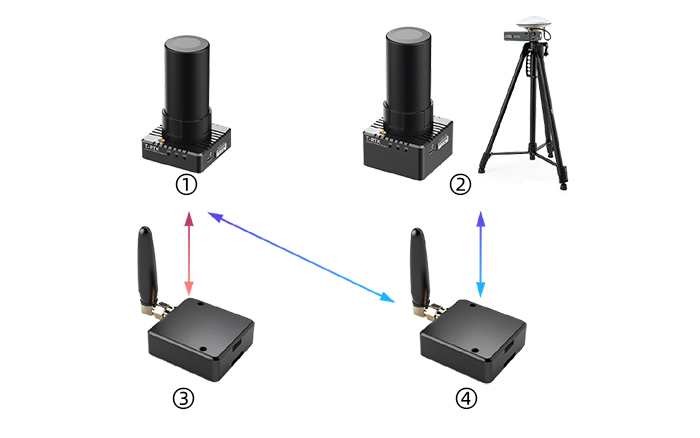
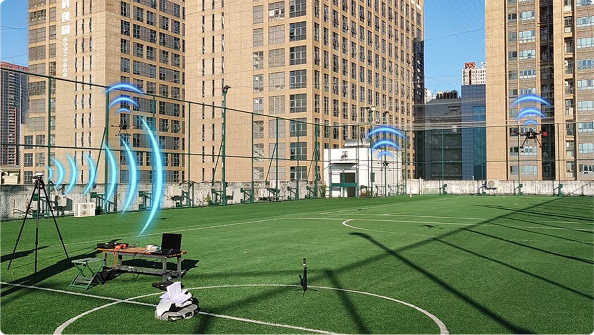
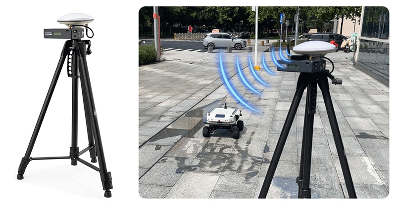
Self Built Base Station + Radio Modem: Widely applicable to UAVs,UGVs,robotics,and various other scenarios.
① One Base ② Base Station (Two Base Station Options Available) ③ Radio Modem ④ Mobile ⑤UAVs/UGVs
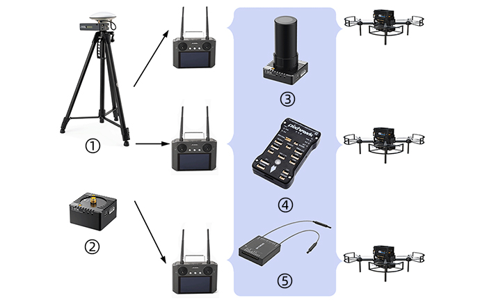
Self-Built Base station + Reusing UAV Transceiver Radio:Exclusively for UAV applications
①OneBase ②Base Station(Two Base Station Options Available) ③Mobile ④Flight Controller ⑤Integrated SPI Receiver
Modular Design
Features a stackable, modular design incorporating mobile units, base station units, 4G communication modules, 5-kilometer radio modules, Wi-Fi hotspots, and other components.
① Mobile ② Base/one Base Station Two Base Station Options Available ③ 4G Modem ④ Radio Modem For specific usage scenarios and configuration options, please refer to the "selection Guide"section above
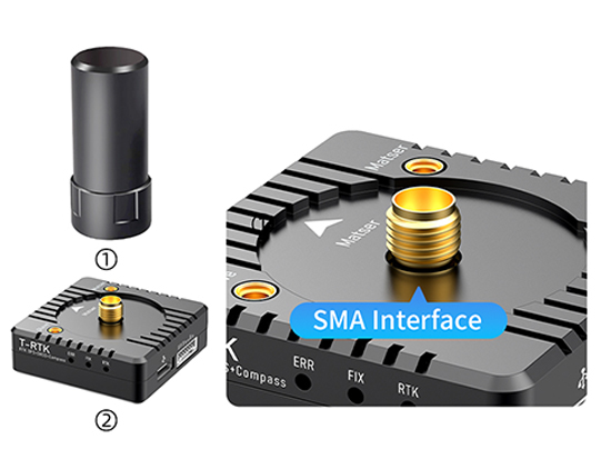
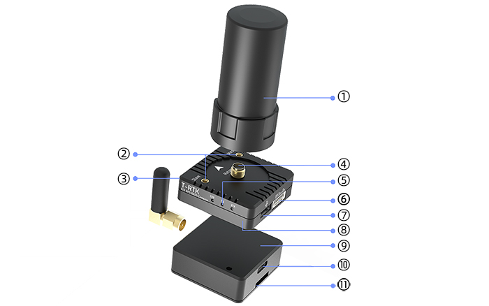
① Quadrifilar Helix Antenna ② MMCX Interface ③ GH 1.25 4pin ④ SMA Interface ⑤ Status Indicator 6 GH1.25 7Pin ⑦ USB Type-C ⑧ Mobile ⑨ Radio Module ⑩ USB Type-C ⑪ SIM Card Slot(For 4G Module
The interface and fixed mode between the base station end andthemobile end are consistent.
Extensive Interface Configuration
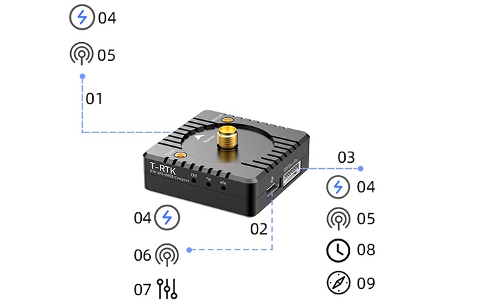
Integrated Type-C (combined power delivery/debugging/communication), dual serial ports (4-pin basic communication + 7-pin flight controller interface), PPS precision timing, and I²C direct connection to magnetic compass.
① GH1.25 4Pin UART ② Type-C ③ GH1.25 7Pin UART (I²C Magnetic Compass) ④ Power Supply ⑤ TTL Communication ⑥ Communication ⑦ Debugging ⑧ PPS Timing ⑨ Magnetic Compass
Multiple Communication Methods
Supports direct connection via radio and hotspot networking, and Python API offering flexible adaptation to diverse scenarios.
① Networking via Radio Modem with a Self-Built Base Station ② RTK Rover Unit on For detailed usage instructions, please refer to the Model Selection Recommendations section above.
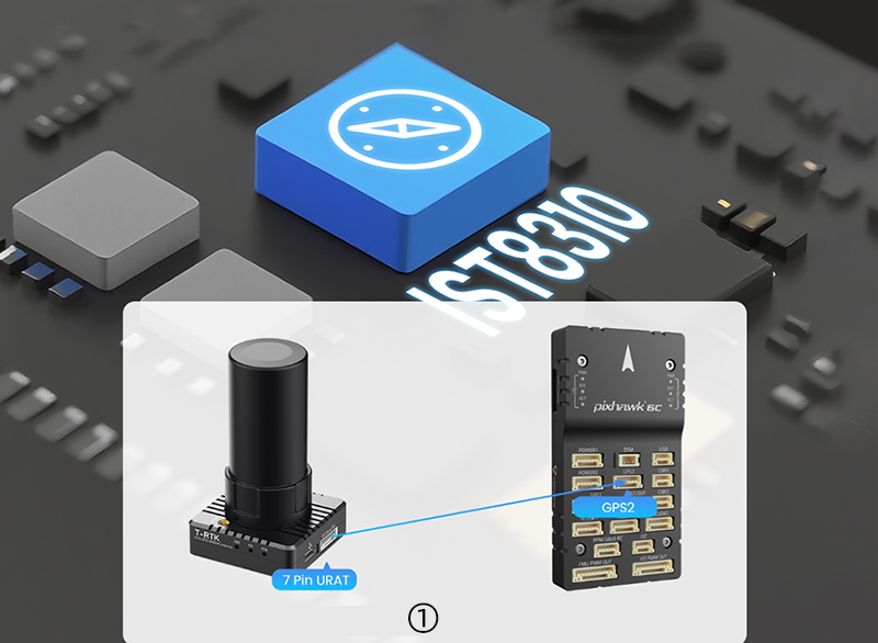
Built-in Magnetic compass Features an integrated IsT8310 magnetometer chip that connects directly to Pixhawk drone flight controllers,enabling high-precision positioning and heading measurement.
① Directly connectable to Pixhawk drone flight controllers
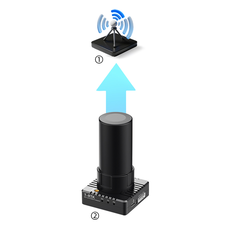
WiFi Hotspot Networking
The base station incorporates a built-in WiFi hotspot for wireless connectivity, enabling UDP-based sharing of RTCM differential data packets.Multiple Mission Planner or QGC ground stations can be paired with remote controllers to achieve drone swarm positioning.
Secondary Development Provides ROS, Python, and C++drivers for easy access to data such as latitude, altitude, longitude,velocity, and heading, enabling, rapid secondary development
Integrated Base Station Optional integrated base station combines the base unit, battery, mushroom-head antenna, and tripod into one compact unit. Offers 8 hours of battery life, lightweight and portable, ready to use right out of the box.
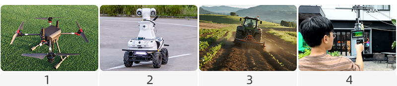
1 UAV 2 Autonomous vehicles 3 Agricultural machinery 4 Surveying equipment Multi-Platform Compatibility Native support for diverse application scenarios including drones, autonomous vehicles, robots, agricultural machinery, surveying and mapping, and environments without CORS services
Parameter
Specification:
Parameter
Model
Mobile End
Base Station End
Integrated Base Station (RM-2UM982 OneBase)
Positioning Module
Model
UM982
UM982
UM982
Basic information
Channels
1408 channels, based on NebulasIV
Antenna Interface
MMCX 2, SMA 1
MMCX 2, SMA 1
SMA*1
Modes
BDS B1I, B2I, B3I, B1C, B2b
GPS L1C/A, L2C, L2P(Y), L5
GLONASS G1, G2
Galileo E1, E5a, E5b, E6
QZSS L1C/A, L2C, L5, L6
SBAS L1C/A
Main Antenna Frequencies
BDS: B1I, B2I, B3I
GPS: L1C/A, L2P (Y)/L2C, L5
GLONASS: G1, G2
Galileo: E1, E5a, E5b
QZSS: L1, L2, L5
Secondary Antenna Frequencies
BDS: B1I, B2I, B3I
GPS: L1C/A, L2C
GLONASS: G1, G2
Galileo: E1, E5b
QZSS: L1, L2
Performance Metrics
RTK (RMS)
Horizontal: 0.8cm + 1ppm
Vertical: 1.5cm + 1ppm
Single Point (RMS)
Horizontal: 1.5m
Vertical: 2.5m
DGPS (RMS)
Horizontal: 0.4m + 1ppm
Vertical: 0.8m + 1ppm
PPP (RMS)
Horizontal: 5cm
Vertical: 10cm
Heading Accuracy (RMS)
0.1° / 1m baseline
PPS Accuracy (RMS)
20 ns
Velocity Accuracy (RMS)
0.03 m/s
Cold Start Time
<30 s
Warm Start Time
< 4 s
Initialization Time
<5s (typical)
Initialization Reliability
> 99.9%
Data Update Rate
Default: 2Hz, Max: 20Hz
Positioning/Heading: 20Hz, Raw Measurements: 20Hz
Differential Data Format
RTCM 3.X
Data Format
NMEA-0183, Unicore
Baud Rate
4800bps~921600bps (Default: 115200bps)
Magnetometer
Model
IST8310
Measurement Range
±1600 μT (X, Y-axis), ±2500 μT (Z-axis)
Offset Temp. Drift
0.024 μT/°C
Physical
Dimensions
39mm× 39mm× 12.5mm
39mm× 39mm× 22.1mm
147mm× 82mm× 36mm
Weight
34g (excl. antenna)
52g (excl. antenna)
386g
Electrical
Voltage
5V
5V
5V
Power Consumption
1300mW
2000mW
2888mW
Runtime
–
–
9h
Environment (RTK Chip)
Operating Temperature
-40℃ ~ +85℃
Storage Temperature
-55℃ ~ +95℃
Humidity
95% non-condensing
Vibration
GJB150.16-2009, MIL-STD-810F
Shock
GJB150.18-2009, MIL-STD-810F
Communication Interface
I2C
1 x I2C (shared with 7Pin UART)
USB
1 x USB
UART
1 x 4Pin UART, 1 x 7Pin UART
1 x 7Pin UART
Integrated Base Station
Tripod Height
Max 1.80m
External Power Port
XT30 x 1 (12V)
Antenna Interface
SMA only
Voltage Display
Supported
4G Module
Network Standard
4G All-netcom (supports China Mobile/Unicom/Telecom)